Asia
118×92 cm
Nicolas de Fer, Paris, 1694 (rarity, the first edition).
This large map of Asia is a part of the wall map series produced by the French royal cartographer Nicolas de Fer, specially created for the French royal court and aristocracy. Thus, the maps of this series were printed in limited numbers and are considered highly rare, particularly the 1696 edition.
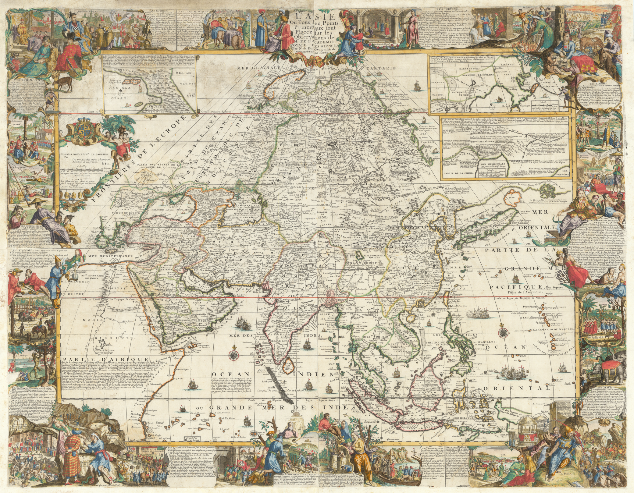
In the upper right section of the map, between the Black Sea (MER NOIRE, PONT EUXIN) and the Caspian Sea, some references about Georgia appear, depicted as GEORGIE and GURGISTAN. These depictions almost entirely cover the region stretching from the Black Sea to the Caspian Sea.
Among the Georgian kingdoms, principalities, and regions featured on the map are: Guria (Guriel), Samegrelo (Mingrelie), Abkhazia (Pais d’Abaza), Imereti (Immirette), Samtskhe-Saatabago (Baratralu), and Kartli (Carduel).
In addition, several settlements and fortress towns are represented, including Gonio (Ghiunia), Kutaisi (Cotatis), Skanda (Scander), Gori (Cori), Tbilisi (Teflis), and Dzegami (Zagen).
Rivers depicted on the map include the Rioni (Fasso / Phasis–Rioni) and the Mtkvari (Kur).
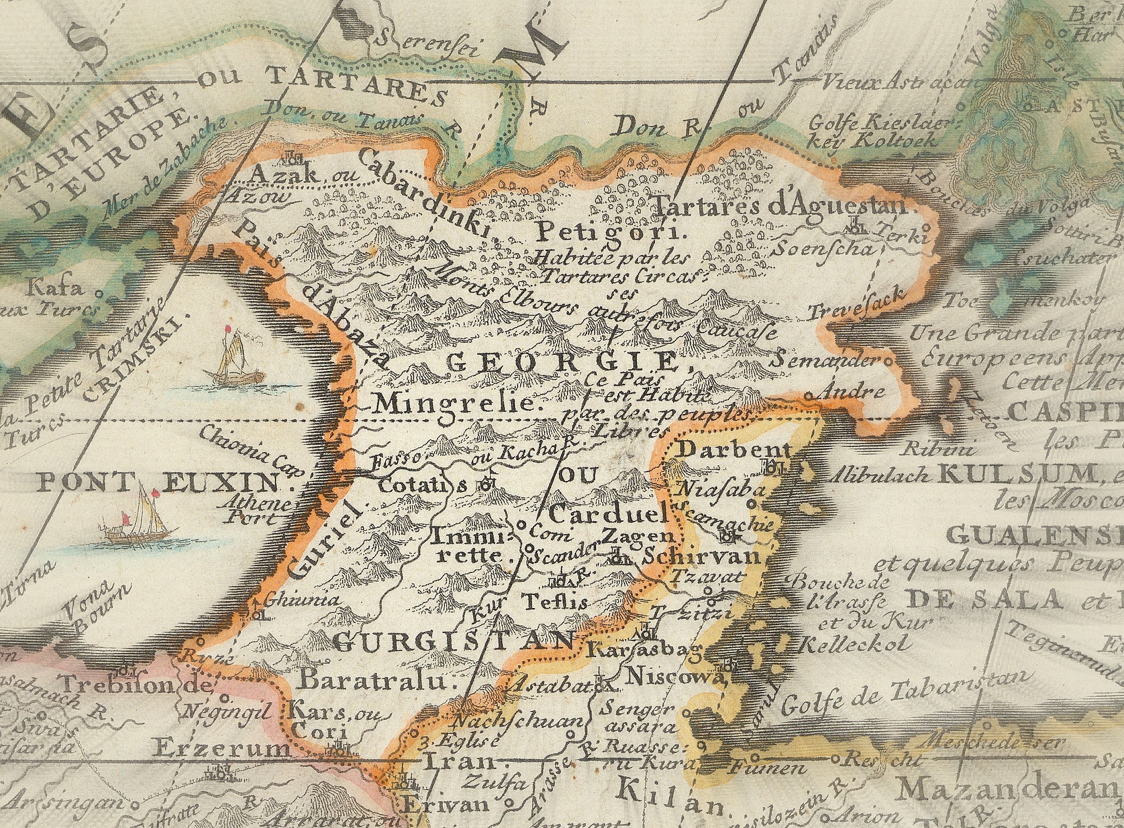
A distinctive feature of de Fer’s map of Asia is the series of illustrations by Hendrick van Loon that frame the map. Three of these directly pertain to Georgia: grape harvesting in Imereti, the purchase of slaves in Samegrelo, and the entry of Georgians into Jerusalem bearing the flag of Saint George. Each illustration has a brief caption, notably the one depicting the Georgians’ entry into Jerusalem, which emphasizes that the privilege of entering the city with flags was bestowed to them.
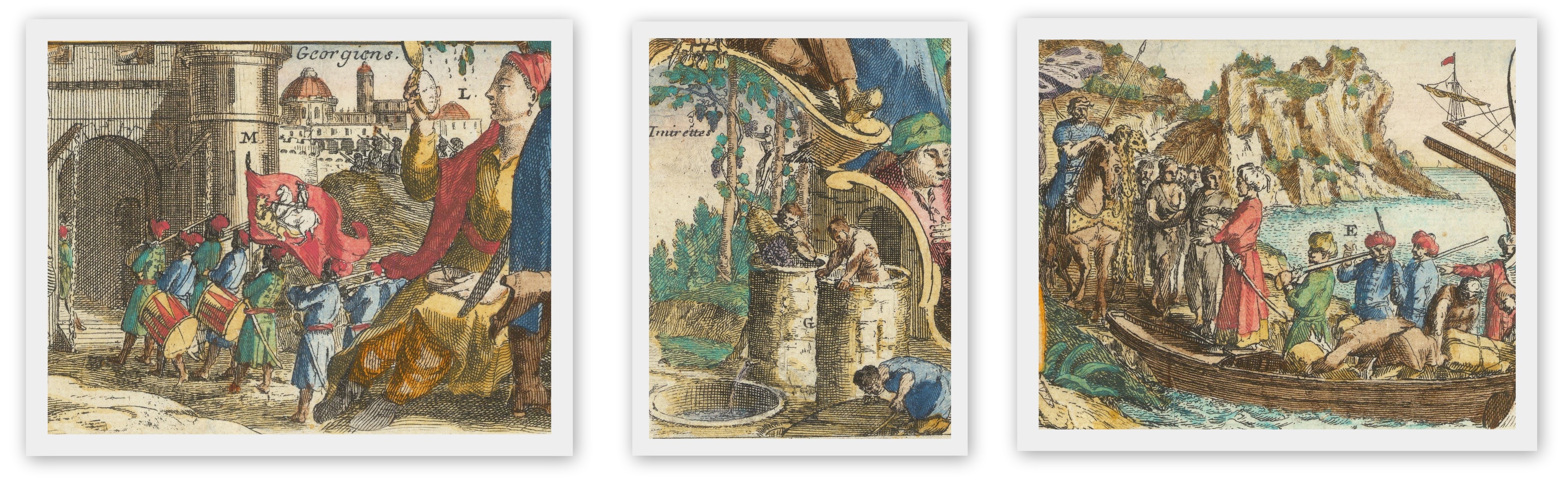
Nicolas de Fer’s map of Asia is, for us, the only known early European map that, in addition to depicting Georgia, is accompanied by illustrations related to Georgia and the Georgian people.


