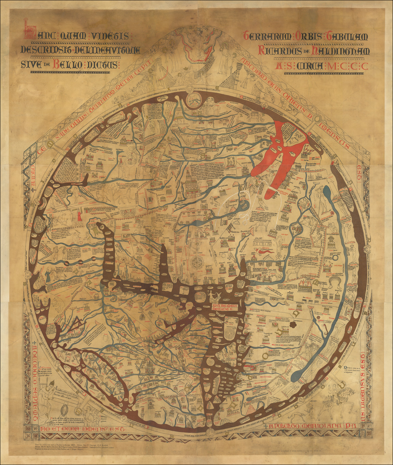
Hereford Mappa Mundi
158x132 cm
Hereford Cathedral, 1283; London, 1872
The Mappa Mundi is considered all time finest surviving example of medieval world maps. It was created at the Hereford monastery toward the end of the 13th century. The map represents a combination of religious and encyclopedic knowledge, designed according to the “T-O” principle: the “O” symbolizes the ocean encircling the entire landmass, while the “T” signifies the land divided into three parts. Specifically: Asia, the largest section, is placed at the top; Europe occupies a part of the lower left; and Africa the lower right.
The map contains more than 500 illustrations, including depictions of cities, animals, plants, mythical creatures, biblical scenes, and a variety of ethnographic representations.
The map features an illustration of the Golden Fleece as well as the designation of Colchis, the ancient Georgian kingdom.


