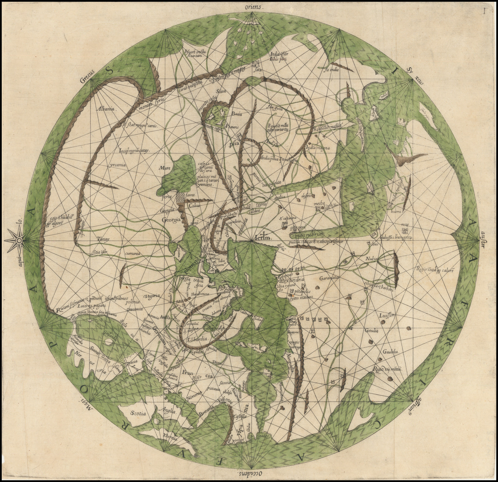
Pietro Vesconte’s World Map
35x32 cm
Pietro Vesconte, Venice, citca 1311-1325
Johann Bongars, Hanau, 1611
On the world map compiled between 1311 and 1325 by the Genoese cartographer Pietro Vesconte, the name “Georgia” appears for the first time in the history of European cartography as the most widespread foreign exonym denoting the country. Therefore, Vesconte’s map may be regarded as the very birth certificate of the toponym “Georgia” within the European cartographic tradition.
The map was produced in the tradition of the so-called mappa mundi maps. It was created according to the “T-O” principle, where the “O” symbolizes the ocean encircling the entire landmass, while the “T” represents the land divided into three parts. Specifically: Asia — the largest part — is placed at the top; Europe occupies a part of the lower left; and Africa the lower right.
Alongside “Georgia,” the map also contains the designation of Colchis (Colcia).
The presented version of Pietro Vesconte’s world map was printed in 1611 in the German city of Hanau by Johann Bongars, and is considered the oldest printed edition of Vesconte’s world map.


