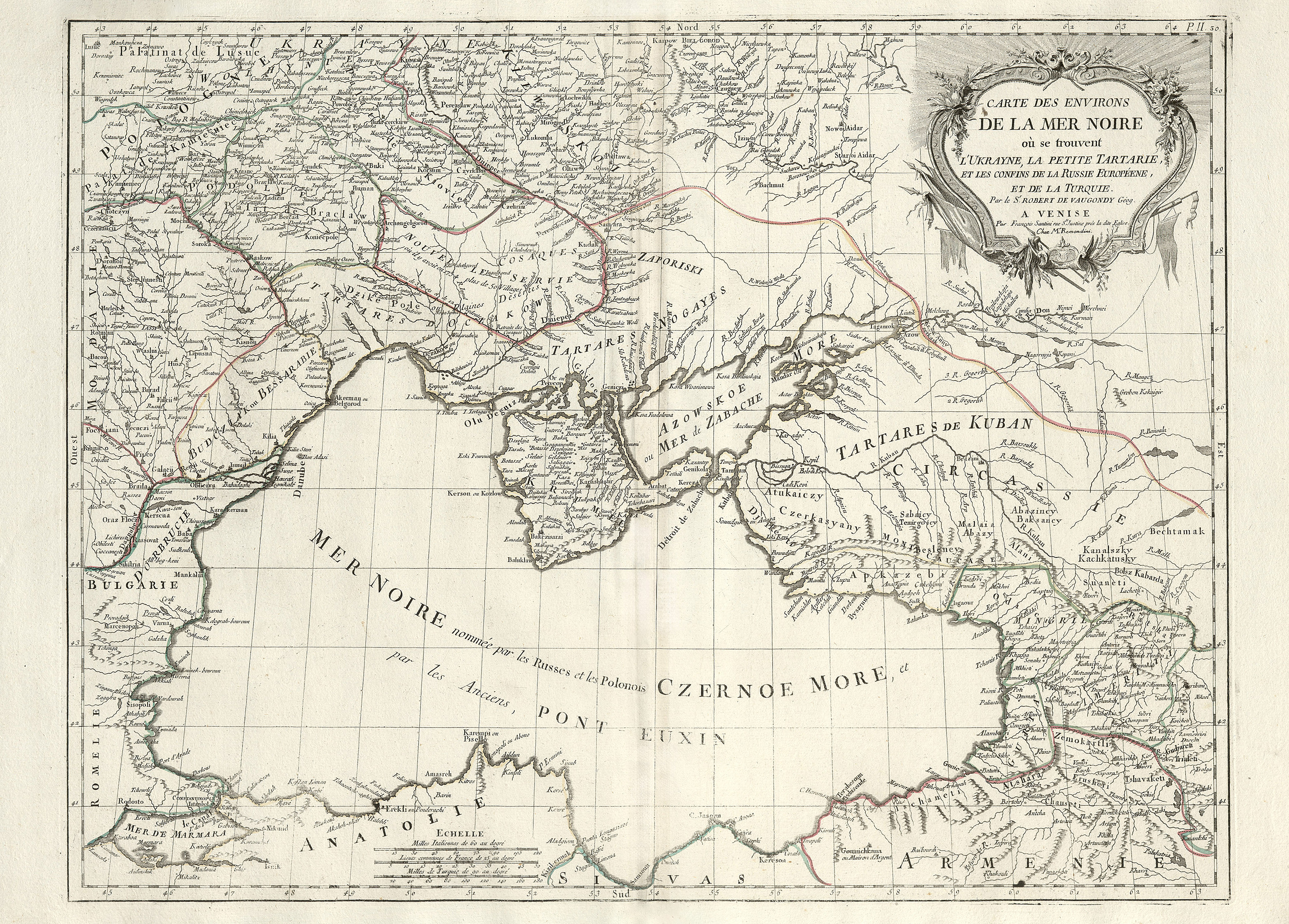
Was printed in Venice between 1776 and 1779 by François Santini
Black Sea Map
This map, created by French royal cartographer Robert de Vaugondy, was printed in Venice between 1776 and 1779 by François Santini.
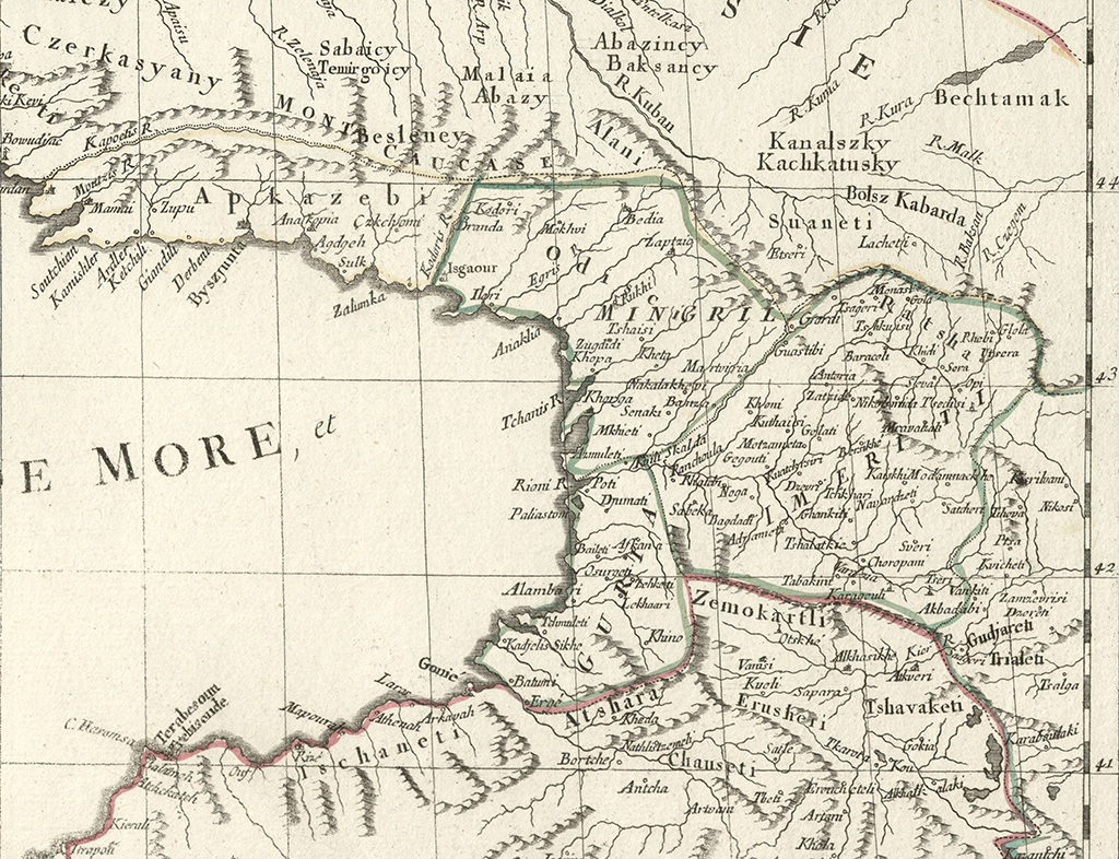
The map primarily focuses on the Black Sea and the surrounding countries, with notable references to Georgia marked on the eastern shore (though it mostly highlights western Georgia).
Information about Georgia on the Vaugondy 's map is sourced from the 1766 Parisian and 1775 Venetian editions of Georgian geographer and historian Vakhushti Batonishvili's Map of the Kingdom of Georgia. As a result, all toponyms related to Georgia are presented in Georgian. e.g. On the map we see the designations as: Apkazebi (Abkhazia), Zemokartli (Upper Kartli), Tshavaketi (Javakheti), Tschaneti (Chaneti) and others. In total, there are more than a hundred Georgia-related designations on the map.


