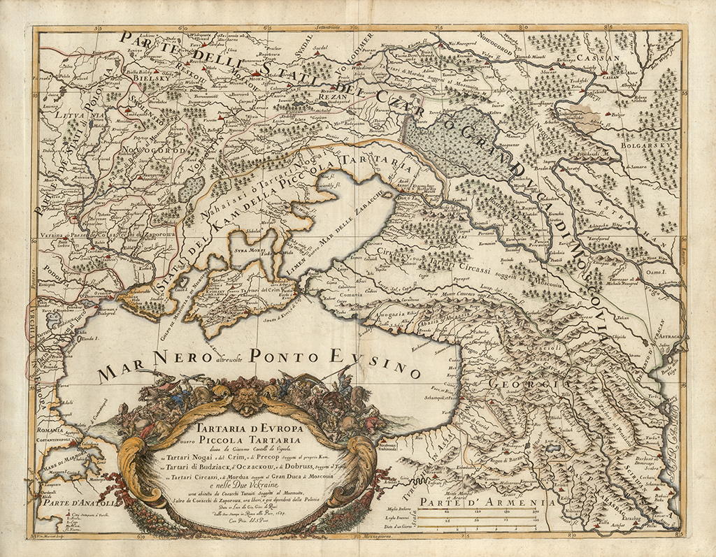
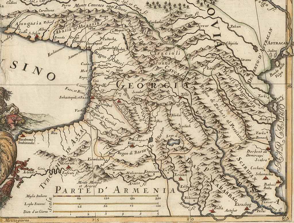
One of the remarkable maps that depict the countries located along the Eastern and Northern coast lines of the Black Sea.
One of the remarkable maps that depict the countries located along the Eastern and Northern coast lines of the Black Sea.
The map presents a large body of references on the eastpart of the Black Sea (Mar Nero, Ponto Evsino) about Georgia. Entire territory of the country fragmented into kingdoms and principalities bears the inscription GEORGIE.
The following kingdoms and principalities of Georgia are marked on the map: Guria (Regno di Guriel), Samegrelo (Mingrelia), Odishi (Regno di Odisci), Abkhazia (Abasia o Abcassia), Svaneti (Scuani), Imereti (Regno d’Imereti ), Kartli (Regno di Carduel), Samtskhe Saatabago (Regno di Baratralu) and Kakheti (Regno di Zacheti). The representations of Samtskhe-Saatabago and Kakheti are accompanied by notes indicating that these regions were under the influence of the Turkey and Persia.
Among fortress cities and settlements featured on the map are: Gonio (Guni), Batumi (Varthi), Faso, et Rioni fl., Khobi (Copis), Anagria (Anagria), Bedia (Bedias), Moquis (Moquis), Sukhumi (Sauatopoli), Satamacia (Satamacia), Pezonda (Pezonda), Khoni (Coni), Kutaisi (Cotatis), Scander (Scander), Akhaltsikhe (Arulcgae), Gori (Kori), Tbilisi (Tiflis), Dzegami (Zagan) and others.


