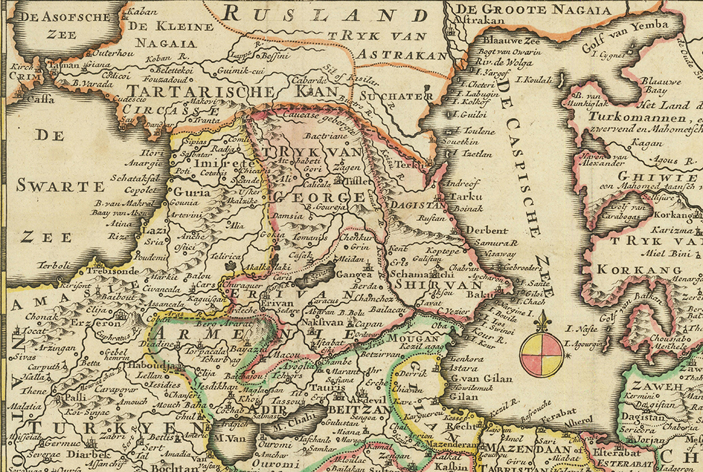
In the upper left section, there are chronicles about Georgia
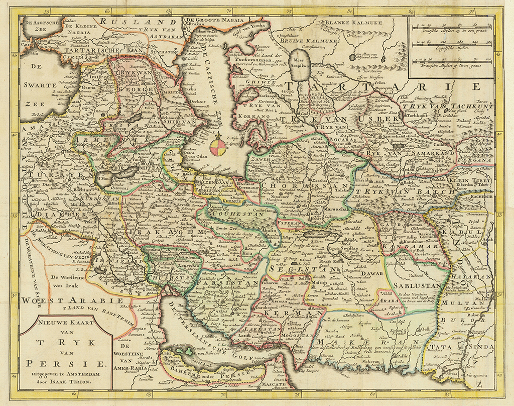
Map of Persia
A map by Isaac Tirion, printed around 1750 in Amsterdam.
In the upper left section, there are chronicles about Georgia. The map marks over 30 cities, churches, monasteries, and fortresses related to Georgia, including: Gounia (Gonio), Copolet (Kobuleti), Schataksal (Shekvetili), Poti (Poti), Anargie (Anaklia), Ilori (Ilori), Dandar (Gagra), Cotatis (Kutaisi), Scander (Skanda, fortress of Scanda), Chicaris (Chkhari/Fortress of Chkhari), Akalzike (Akhaltsikhe), Gokia (Gokia), Akalkalaki (Akhalkalaki), Atchabeti (Achabeti), Gori (Gori), Tifflet (Tbilisi), Damsia (Tandzia), Tamanis (Dmanisi) B. Goureja (Gareji) and others.
The map depicts TRYKVAN GEORGIE, Imirete (Imereti), Radja (Racha) and Guria (Guria).


