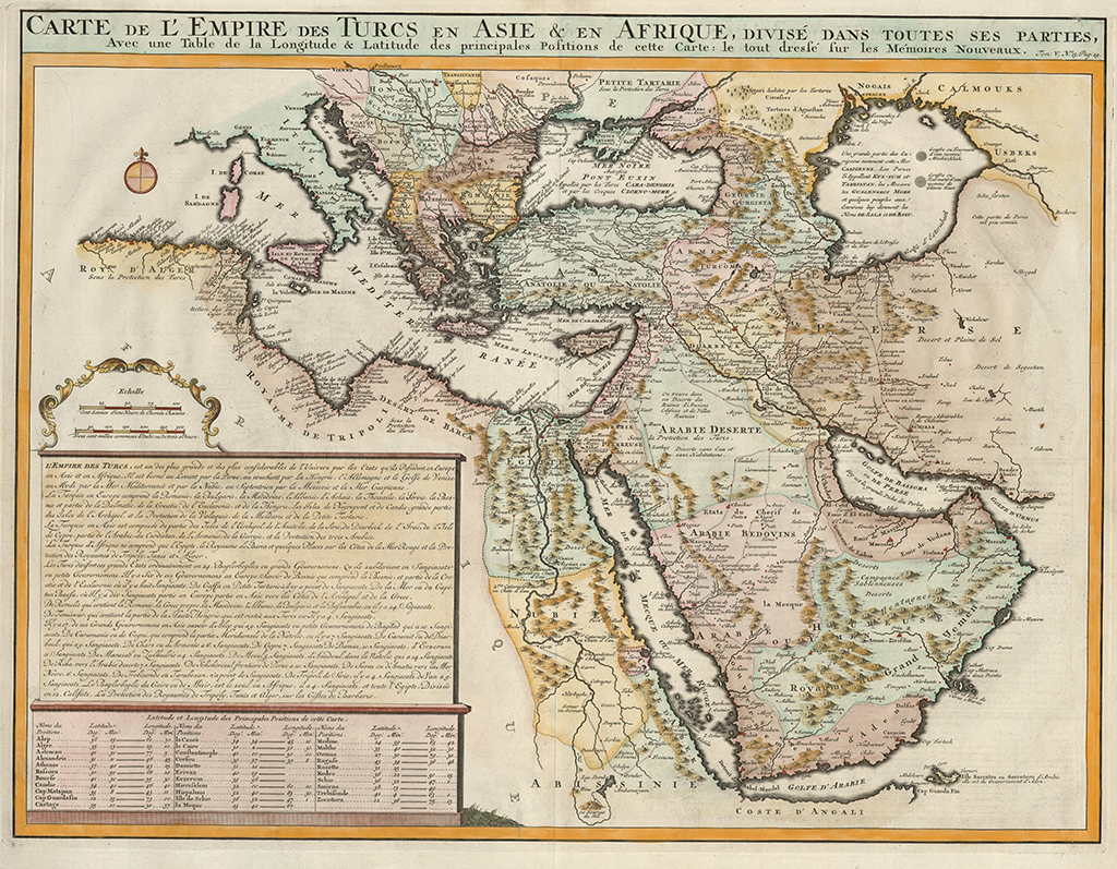
was printed in Henri Abraham Chatelain’s Atlas of History
The map was printed in 1719 in Henri Abraham Chatelain’s Atlas of History and covers a large area including the eastern Mediterranean, Italy, the Balkans, Asia Minor, the Black Sea, the Caucasus, Arabia, and the Middle East.
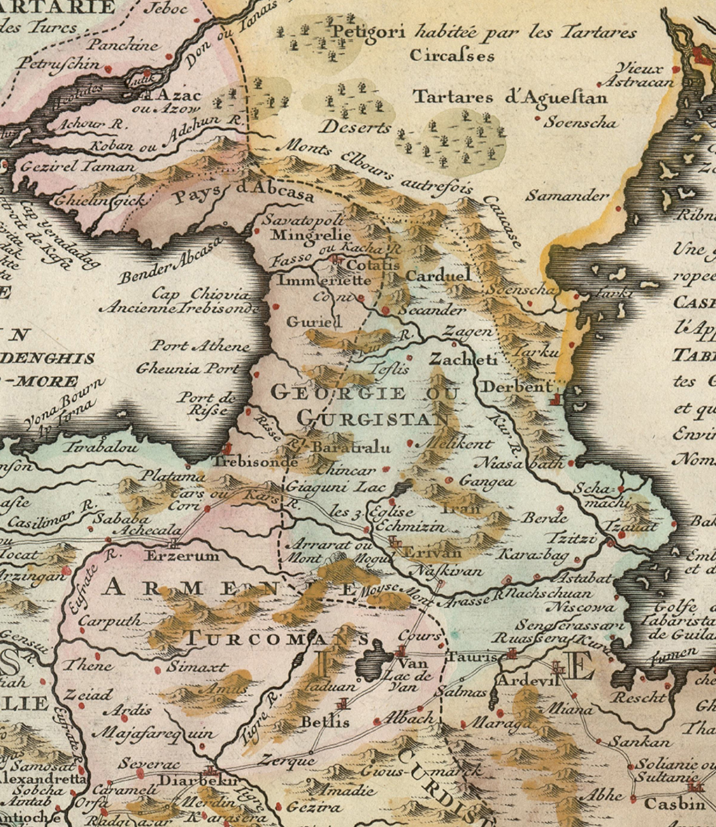
The map contains important details about the countries between the Black and Caspian seas. Toponyms "GEORGIE" and "GURGISTAN" are used to denote Georgia. It is easy to read Guriel" (Guria), "Mingrelie" (Samegrelo), "Immeriette" (Imereti), "Baratralu" (Samtskhe), "Carduel" (Kartli), "Zacheti" (Kakheti), "Chenia port" (Gonio), " Savatopoli" (Sukhum), "Cotatis" (Kutaisi), "Coni" (Khoni), "Secander" (Fortress of Scandi), "Teflis" (Tbilisi), "Zagen" (Zəyəm) and others.
The following cities and settlements can also be seen on the map: "Echmizin" (Ejmiatsin), "Erivan" (Erevan), "Naskivan" (Nakhchivan), "Bakuie" (Baku), "Schamahi" (Shamakhi), "Gangea" (Ganja) and others.


