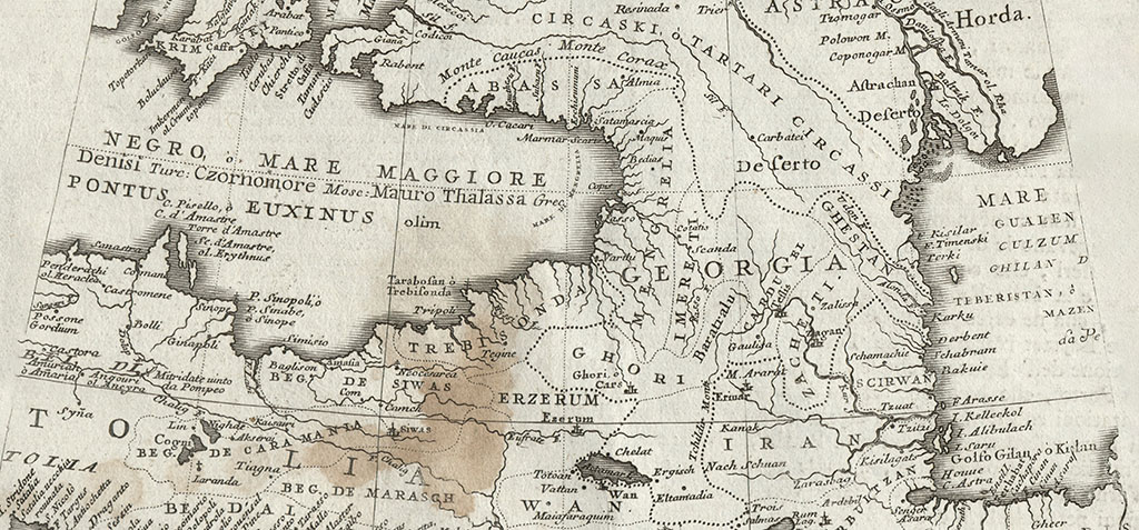
Eastside of the Black Sea, there are details about Georgia
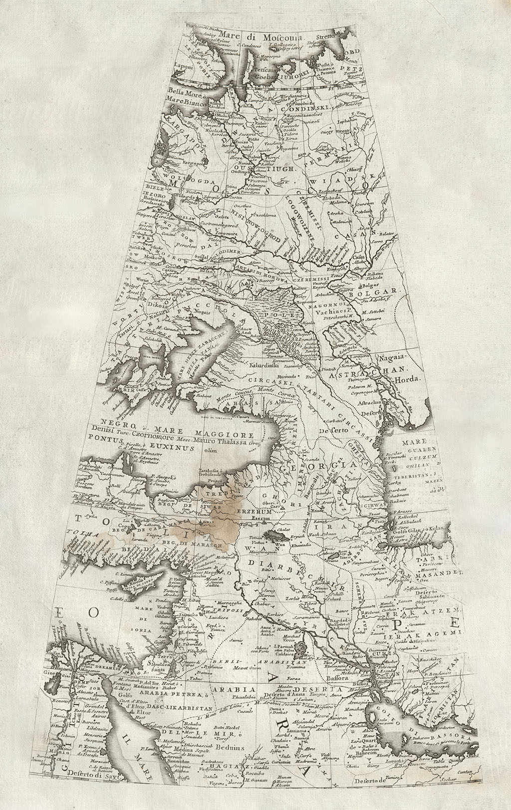
Part of the Globe Map
A 1696 edition of a partial globe map created by Venetian cartographer Vincenzo Maria Coronelli.
In the center of the map, eastside of the Black Sea, there are details about Georgia. The country is labeled under a common name GEROGIA, when it was divided into various kingdoms and principalities.
Among the kingdoms and principalities marked are: MENGRELIA (Samegrelo), ABASSA (Abkhazia), IMERETI (Imereti), Baratralu (Samtskhe), CARDUEL (Kartli), and ZACHETI (Kakheti).
Several fortress cities of Georgia are denoted on the map, including Varthi (Batumi), Fasso (Fazis), Copis (Khobi), Bedias (Bedia), Moquis (Mokvi), Satamashia (Satamashia), Eschisumuni (Sukhumi), Cotatis (Kutaisi), Scanda (Skanda), Teflis (Tbilisi), Zalisa (Dzalisa), Zagan (Dzegami), and more.
This uniquely shaped map by Coronelli is also notable for showing local names of the Black Sea, such as MARE DI MENGRELIA, near the shores of Samegrelo.


