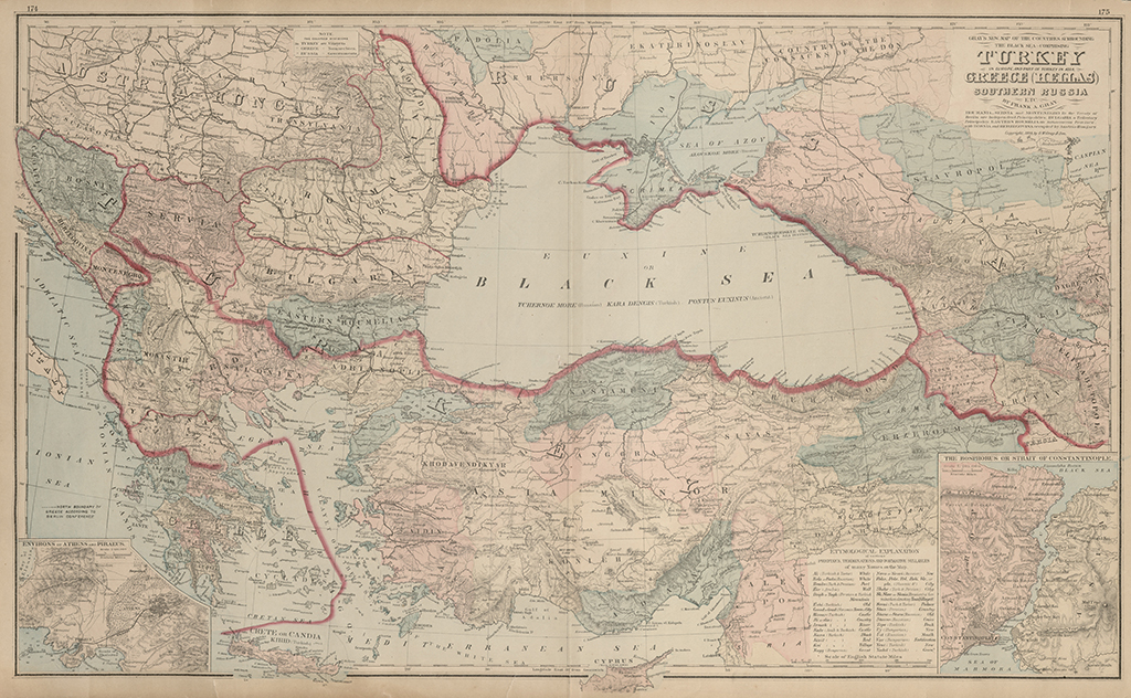
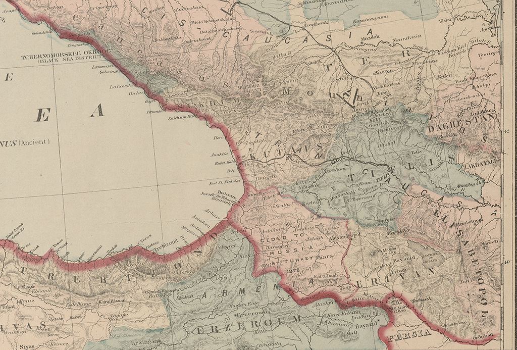
Comprising Turkey in Europe, and part of Turkey in Asia, Greece (Hellas). Southern Russia etc.
The map features the countries of the Black Sea Basin and illustrates the aftermath of the Russo-Turkish War of 1877-1878. Along the eastern coast of the Black Sea, under the label 'TRANSCAUCASIA,' the gubernias within the Russian Empire's territory are depicted. Marked on the map are Batumi, Keda, Skhalta, Ozurgeti, Poti, Khobi, Zugdidi, Anaklia, Ilori, Sukhumi, Gagra, Kutaisi, Gebi, Oni, Atzuri, Akhaltsikhe, Khertvisi, Borjomi, Gori, Dusheti, Fasanauri, Kobi, Gudauri, Tbilisi, Telavi, Sighnaghi, and others.
Additionally, it shows Yerevan, Alexandropol (modern-day Gyumri), Bayazid, Nakhichevan, Elizavetpol (modern-day Ganja), and other geographical locations.
The rivers Chorokhi, Rioni, Mtkvari, Khrami, Iori, and Alazani are clearly readable. Among the lakes, Crdili, Paravani, and Sevan are denoted.
On the reverse side of the map, there are also maps of the European parts of Russia and Italy.


