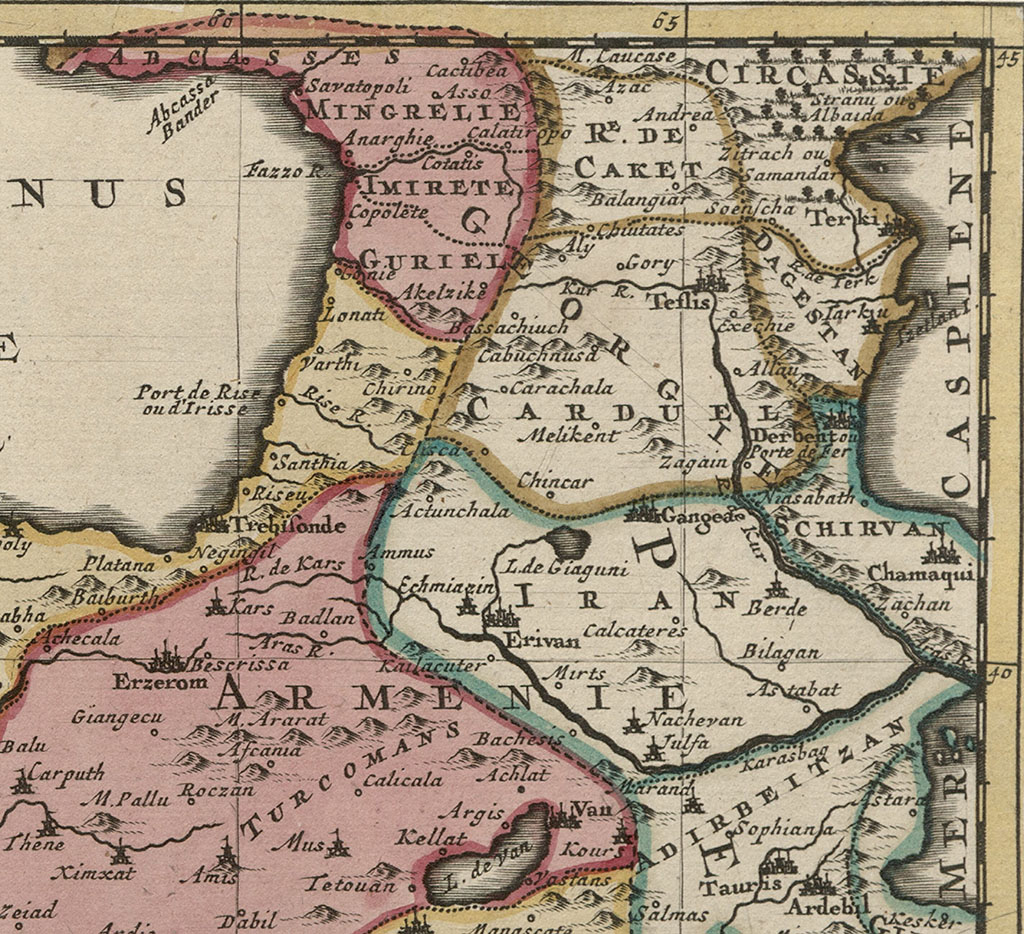
Along the Black Sea, the map includes details about Georgia
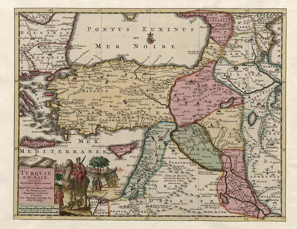
Turkey in Asia
This map of the Asian part of Turkey was printed in Leiden in 1713 by Pieter van der Aa.
In the upper right corner, along the Black Sea, the map includes details about Georgia. The country, divided into kingdoms and principalities, is marked with the inscription GEORGIE, indicating that the cartographer from Leiden regarded the people living in these lands as part of one nation.
Several regions are denoted on the map, including GURIEL (Guria), IMIRETE (Imereti), MINGRELIE (Samegrelo), ABCASSES (Abkhazia), CARDUEL (Kartli), and CAKET (Kakheti).
The map by Pieter van der Aa also depicts several fortress cities and rivers in Georgia: Varthi and Lonati (both used to indicate Batumi on old European maps), Copolote (Kobuleti), Fazzo R. (Rioni River), Anarghie (Anaklia), Savatopoli (Sukhumi), Cotatis (Kutaisi), Akelzike (Akhaltsikhe), Ali (Ali), Kur R. (Mtkvari River), Carachala (Karajala), Gory (Gori), Teflis (Tbilisi), and more.


